
Wednesday, September 24, 2008
Tuesday, July 29, 2008
riverfront
the riverfront design is somewhat a design response to the cultural park riverfront design. the cultural park implements a "esplanade." the intent is the same as the cultural park - create a more pedestrian friendly atmosphere, but unlike the formal design of the cultural park, the design here is more free flowing. the design on the downtown portion looks at creating an artificial terrain, not attempting to re-create what was there or creating a contrived "mini-canal" as seen in the current design for the scioto mile, but creating a unique landscape design. the design was derived in part by the town street bridge, where the landscape undulates creating differing slopes - the difference here, the slopes/undulations less steep, to allow ease of access.


Sunday, July 27, 2008


Saturday, July 26, 2008
Urban Boulevard
The goal of the urban boulevard is to create an architectural, pedestrian and social environment - see sheet for additional information. The images included are enlarged plans, sections and vignettes of two major components of the boulevard - a bench in the median busstop, the third component would simply be an open median for various activities (i.e. kiosks, street performers, food stands, etc.).


Sunday, July 20, 2008
Cultural Park
Cooper Robertson and Associates worked on a Masterplan for the Scioto Pennisula, termed the Cultural Park. The mission statement was this: "The intent of the Central Park concept is a Park design in which the open space dominates, and the buildings become "background" as subordinate to the larger whole. The Penisula is not a collection of buildings, but an integrated park."
The plan was conceived and published by Cooper Robertson and Associates in 1991, the design was to include a large open bowl (ampitheater - additionally the old Central High was to be demo'd.) facing the Supreme Courthouse on the opposite side of the Scioto. Behind the bowl would be a large central garden and behind that would be a large open area for festivals such as the Pumpkin or Tomato Festivals. Flanking the gardens and bowl would be the relocated Musuem of Art (to the south) and COSI (to the north).
Around the same time the concept for the COSI (Center of Science and Industry - childrens science museum) was to be relocated, the determination was to locate it at the penisula, where the large bowl was to be located. The building, designed by Arata Isozaki, was to use the old Central High (vacant for many years at the time). The design (see below) utilizes a large precast concrete panel system that essentially blocks Franklinton from the downtown area. While, the design is interesting, it creates a large boundry between Franklinton and downtown.
The goal is to implement both the cultural pennisula and the existing COSI building (with some interventions) with the bridge design. The intent is taht the cultural park adds a strong pedestrian element to the project, further emphasizing the intent of creating a "ramblas"/urban pedestrian boulevard where people could traverse both sides of the river.
Ariel:

Cultural Park:

COSI:

COSI:

Monday, July 7, 2008


Sunday, June 15, 2008
Where to go from here?
Based on the comments from the review, I will be working on revising the masterplan for Columbus - specifically, working on some scale issues, further refining transportation routes, and looking for additional pedestrian environments as precedents to learn from.
The specifics for the masterplan will be to further research vehicular and pedestrian relationships (i.e. Las Ramblas in Barcelona - how the pedestrian movement is on both sides and on a center island and maybe looking at the Short North in Columbus for strategies on this relationship). Additionally, I will work on refining the scale on certain portions of the masterplan and additional relationships between buildings and roads.
A phasing plan will also be developed, so that it might add additional validity to the overall scheme. Preliminary thoughts on phasing:
Phase 1: adaptation of the existing transportation arteries (the main pedestrian movement) and mass transit hub/lines along with a catalyst project - potentially the bridge (allow for a connection with downtown Columbus and Franklinton/Scioto Pennisula)
Phase 2a: retail growth along the two major axis (High Street and Town St) within the core. - riverfront/boardwalk
Phase 2b: residential growth and cultural building
Phase 3: offices along the riverfront
Phase 4 government square
Based on completion of the masterplan, I will be moving forward with a bridge design at Town St - which will be a multi-use element, something that will allow for vehicular traffic as well as pedestrian movement as well as incorporating a transit hub and small scale retail and public space (leisure activity, gathering spaces for festivals, etc). The programming for this portion of the project will be dictated in part by the results of the masterplan and the phasing plan.
Precedent to look at:
Yokohama Port Terminial: FOA
-FOA implemented a landscape that was occupiable at the roof line that moved throughout the building as well as incorporating several use groups in the building.
Intensive: Presentation and Additional Images from Intensive
Select Images of the "final" presentation at the Boston Intensive:
Presentation:


Study Models:
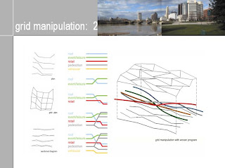
Grid Manipulation Models:


Movement Sketch Models:


Presentation:


Study Models:
Grid Manipulation Models:


Movement Sketch Models:


Monday, June 2, 2008
Critque Comments
Items/comments from Intensive review 5.31.08:
1. Further document the area under investigation and define the areas that do not work and show how the masterplan addresses the problems/issues.
2. Analyze the proposed masterplan so that the interventions address the issues clearly - make the parti clear.
3. Can the river address the buildings rather then having buildings address the river? By implementing the pedestrian bridge, the Scioto Pennisula needs to be addressed as an area of redevelopment.
4. Masterplan vs. Building? What direction do I move forward with? Can simply focusing on one building serve as the catalyst for the masterplan?
Wednesday, May 28, 2008
Situationist International
Suggestions from Denise:
http://en.wikipedia.org/wiki/Situationist_International
http://www.youtube.com/watch?v=2SvdWk8zRrI
http://www.cddc.vt.edu/sionline/
http://en.wikipedia.org/wiki/Situationist_International
http://www.youtube.com/watch?v=2SvdWk8zRrI
http://www.cddc.vt.edu/sionline/
Monday, May 26, 2008
Street Car Article
Article on Street Cars that was in the Columbus Dispatch:
The article addresses some of the local thought regarding the streetcars coming to Columbus.
http://www.dispatch.com/live/content/insight/stories/2008/05/25/scquestions.ART_ART_05-25-08_G1_5JA9DIN.html?sid=101
The article addresses some of the local thought regarding the streetcars coming to Columbus.
http://www.dispatch.com/live/content/insight/stories/2008/05/25/scquestions.ART_ART_05-25-08_G1_5JA9DIN.html?sid=101
Saturday, May 24, 2008
Entertainment/Residential/Retail Blocks
The developments facing both High Street and Main Street would be developed so that both scale and materiality would blend in with the historical nature of the existing buildings that would remain - although not necessarily the same architectural expression. The buildings facing both High and Main Streets would be retail on the first level - the second floor could be additional retail space or offices (residential would not work due to extreme length and lack of natural light).
The remaining development depicted in the posting would be composed of retail/entertainment use on the lower levels and residential units above (i.e. the taller blocks in section). The goal is to create an atmosphere of constant change throughout the day: morning - afternoon - early evening - late night.
Morning= subdued (breakfest)
Afternoon= lively (lunch and shopping)
Early evening= intimate (dinner and live music)
Late night= energetic (bars, clubs and live entertainment)

Wednesday, May 21, 2008
Government Block
The buildings portrayed in the government block represent several functions, government/agency office spaces, historical elements and to serve as a "bookend" to the government space in the downtown area. The office buildings (three large green masses) are meant for the elected officials to have there primary office spaces as well as various government agencies. The buildings are portrayed as glass buildings, however they can vary. The building in the center, would serve as a museum (historical society would be relocated to this location and a state museum) as well as containing the state library. The buildings materiality is portrayed as limestone, sympethetic to the materiality of the state capitol's limestone facades. The courtyard would serve as a leisure space that could serve as impromptu gathering spaces.


Monday, May 19, 2008
Riverfront District
The images posted are for the riverfront district of the masterplan. The following postings will follow a similar format (on a sheet with description).


Subscribe to:
Posts (Atom)